Where The River Ends
The delta is easy to do badly: a pontoon, a snake, a photograph. We use the same family in Ben Tre each season, which is why the lunch tastes like lunch rather than like a tour stop.
Life On Water
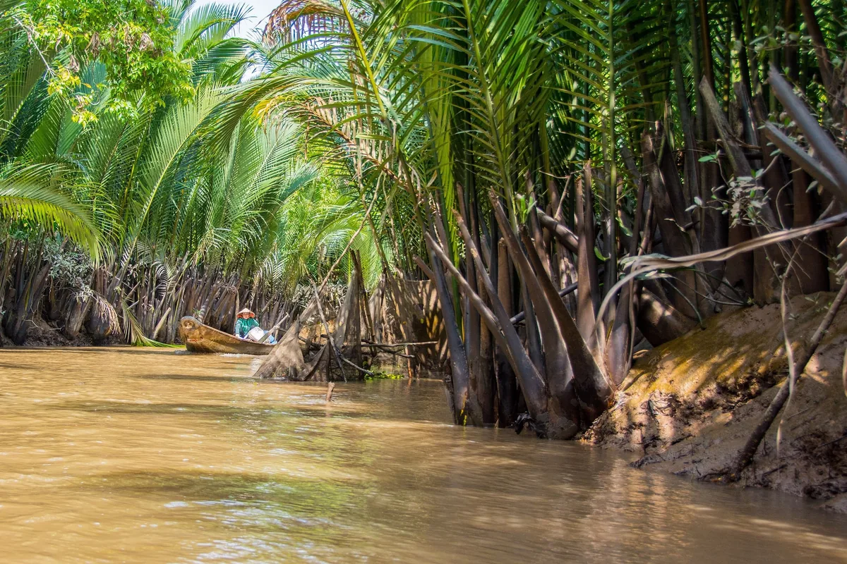
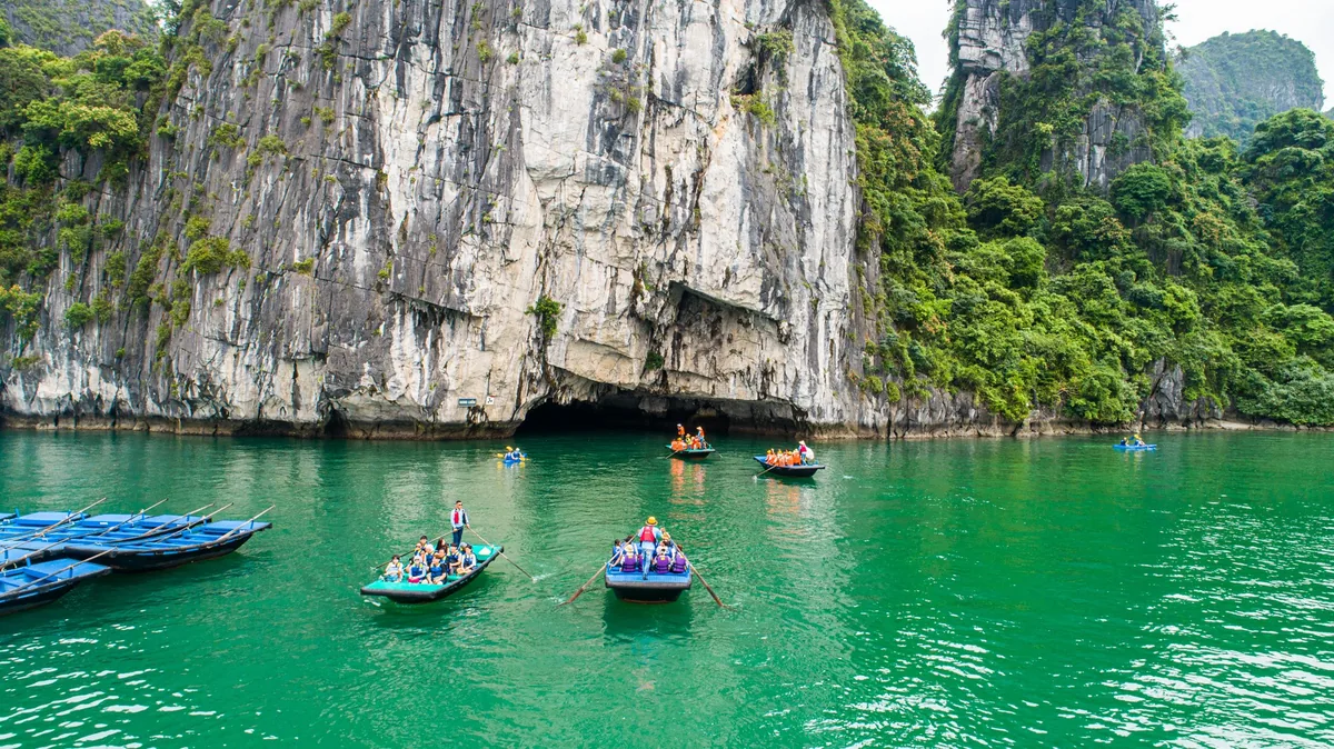
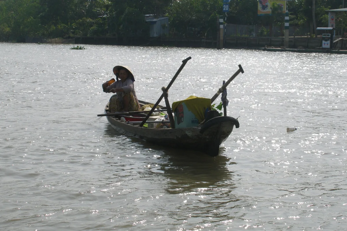
The delta was settled along waterways long before it had roads, and the pattern holds. Houses face the canal, with steps down to it. Freight still moves by barge: rice, sand, coconuts, roof tiles. The good hours are the first two after dawn, when the market boats trade and the water is still. Hire a small sampan rather than a big launch and go up the narrow channels.
Orchards And Coconut
This is the country’s fruit basket: pomelo, longan, rambutan, durian, mangosteen, jackfruit, and mangoes in spring. Around Ben Tre it is coconut, pressed for oil, boiled into candy, the husks woven into mats and rope. Small family workshops still make rice paper, puffed-rice cakes and coconut caramel by hand, and will show you how without much ceremony.
Three Faiths Close Together
The delta is religiously crowded in a way the rest of Vietnam is not. Khmer Theravada monasteries with gilded roofs stand near Chinese temples, Catholic churches from the French period, Cham Muslim villages on the upper river, and the Cao Dai and Hoa Hao movements, both founded in this region in the twentieth century. Several are worth a stop for the architecture alone.
Top Highlights
- Reach Cai Rang floating market before six in the morning, while the wholesale boats are still trading, in a small sampan rather than a launch.
- Cycle the lanes on the coconut islands near Ben Tre, stopping at the workshops that boil coconut caramel by hand.
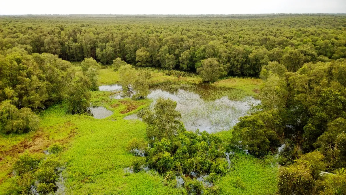
- Row through the flooded cajuput forest at Tra Su, where duckweed covers the water in a solid green sheet.
- Climb Sam Mountain above Chau Doc at the end of the day for the view out across the border into Cambodia.
- Sleep a night in a homestay on a canal, and find out how loud a delta dawn actually is.
- Visit a Khmer monastery near Soc Trang or Tra Vinh, where Theravada practice and Khmer script have continued unbroken.
Region
Southern Vietnam: Can Tho, Vinh Long, Dong Thap, An Giang
Airport
Can Tho (VCA); most arrive by road from Ho Chi Minh City
Best Months
December to April
Suggested Stay
Two to three nights
Known For
Floating markets, orchards, canals, Khmer temples
Pairs With
Ho Chi Minh City, Phu Quoc, Phnom Penh
The delta occupies the whole southern tip of Vietnam, from the Cambodian border down to the Ca Mau peninsula: flat, wet, and mostly less than two metres above sea level. Two main arms of the Mekong run through it, the Tien and the Hau, splitting repeatedly, and a dense network of dug canals ties them together. Some of those canals are two centuries old.
Administratively it looks different from any map printed before mid-2025. The July 2025 mergers cut the number of provinces sharply. Can Tho now takes in the former Soc Trang and Hau Giang; An Giang absorbed Kien Giang; Vinh Long took in Ben Tre and Tra Vinh; Dong Thap took in Tien Giang; Ca Mau absorbed Bac Lieu.
The towns themselves did not move. Can Tho remains the delta’s largest city and the usual base, and Chau Doc, My Tho, Ben Tre, Vinh Long, Sa Dec and Tra Vinh are all what they were. Only the province names on the signs changed.
They are real, they are old, and they are shrinking. Boats gathered at river junctions to trade wholesale because that was the efficient way to move produce before roads existed. Roads now exist.
Cai Rang, outside Can Tho, is the largest survivor. Local authorities have counted around 200 boats trading regularly in recent years, against roughly 500 in 2016 and more than that in the 1990s. Phong Dien, nearby, is down to a handful. Cai Be, on the Tien river, effectively closed as a wholesale market early in the decade, though tour boats still visit the area.
What that means in practice: go early, because the trading is finished by eight and thinner by seven, and go with realistic expectations. What remains is a working market at reduced scale, not a performance, and the vendors still advertise by hanging a sample of their produce from a pole on the bow.
Treat the market as one hour of a longer day on the water, not the reason for the trip.
December to April is the dry season and the easiest travelling: warm, bright, calm water, roads and paths dry underfoot. March and April get properly hot.
May to November is the wet season, with afternoon downpours rather than continuous rain. From roughly August to November comes the annual flood the delta calls the floating season, when water spreads across the upper provinces around Chau Doc and Dong Thap. It is not a disaster. It is the event the whole agricultural year is built around, it lays down the silt and it brings the fish. The flooded cajuput forests and the bird colonies are at their best then.
Fruit runs from roughly May to August, which is the sweetest time to be here and also the wettest.
Two things to know. Mosquitoes are a fact of life near water at dusk, and the delta has no cool season at all. Expect around thirty degrees and high humidity whenever you come.
Most people come by road from Ho Chi Minh City. My Tho and Ben Tre are about two hours on the expressway; Can Tho is three to four, crossing the cable-stayed bridge over the Hau; Chau Doc, on the Cambodian border, is five to six. New expressway sections keep opening and the times keep improving.
Can Tho has an airport with domestic flights, which suits anyone short of time or continuing to Phu Quoc.
There is also a river route to Cambodia. Boats run up the Hau from Chau Doc to Phnom Penh, with border formalities at Vinh Xuong and Kaam Samnor, and it makes a far better crossing than the bus.
Within the delta you need a car for the distances between towns and a boat for most of what is worth seeing. Good operators use small local craft on the narrow canals. Bicycles work well on the island lanes around Ben Tre and Vinh Long, where everything is flat.
It is worth understanding what is happening here, because it shapes what you see.
Upstream dams in China and Laos hold back water and, more importantly, sediment. Less silt reaches the delta, so the land no longer builds itself at the coast, and parts of the shoreline are retreating. Sand extraction from the riverbed makes it worse.
Groundwater pumping has caused the ground itself to subside, in places faster than the sea is rising. Salt water pushes further inland in the dry season than it used to, and severe intrusion in recent drought years reached well up the river arms, damaging orchards and rice.
Young people leave for work in Ho Chi Minh City and the industrial zones around it, and many delta villages skew old. Farmers have responded by changing what they plant, moving from three rice harvests to two plus fruit or shrimp, and by building embankments.
None of this makes the delta a poor place to visit. It makes it a place worth listening to while you are there.
One night in the delta is a day trip with a bed attached, and the common version — coach to My Tho, forty minutes in a boat, coconut candy, home again — is why some people leave unimpressed.
Two nights works. Drive down to Vinh Long or Can Tho, spend the afternoon on small canals, sleep by the water, be at Cai Rang before six, then use the rest of the morning for orchards and back lanes before turning for home.
Three nights is where it opens up. Add Chau Doc: Sam Mountain, the Cham Muslim villages along the river, the fish farms under the floating houses and the cajuput forest at Tra Su. Or go the other way to Tra Vinh and the Khmer monasteries, which very few visitors reach.
Homestays here are genuinely modest — a mattress, a mosquito net, a fan, shared washing. The food is usually the best you will eat in the delta.
Journeys through Vietnam
Departures that take in this part of Vietnam, plus the other places we cover there in depth.